Audience

Companies and professionals in need of a photogrammetry software solution for mobile and drone mapping

About Pix4D

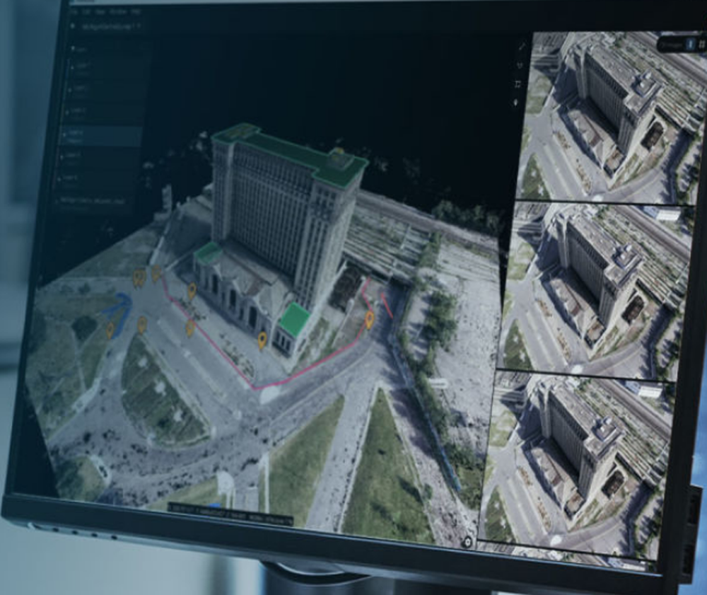
The only drone mapping & photogrammetry software tools with a flight app, desktop, and cloud platforms. Rely on Pix4D’s processing algorithms to get the survey-grade results you expect. Choose the AutoGCPs feature for even greater accuracy. Get an instant view of any jobsite from anywhere, on your browser, in 2D and 3D, with results you can measure, explore, compare, share and collaborate on. Keep a permanent and up-to-date record of the project and resolve disputes efficiently. Capture images or point clouds with a drone or any laser scanner. When using a drone, automate and optimize your flights with the free PIX4Dcapture mobile app. Use the combined power of images and point clouds to extract key elements from photogrammetry, laser scanning or LiDAR data. Survey curbs, building footprints, walls, catenary curves and more. Work 50% faster when you vectorize from point clouds and verify in images, while the Smart Grid saves 1,000s of clicks creating spot elevations.

Pricing

Starting Price:
$32.50 per month
Free Trial:
Free Trial available.

Integrations

API:
Yes, Pix4D offers API access

Ratings/Reviews

Overall 0.0 / 5
ease 0.0 / 5
features 0.0 / 5
design 0.0 / 5
support 0.0 / 5

This software hasn't been reviewed yet. Be the first to provide a review:

Review this Software

Company Information

Pix4D
Founded: 2011
Switzerland
www.pix4d.com

Videos and Screen Captures

Pix4D Screenshot 1
Other Useful Business Software
MongoDB Atlas runs apps anywhere Icon
MongoDB Atlas runs apps anywhere

Deploy in 115+ regions with the modern database for every enterprise.

MongoDB Atlas gives you the freedom to build and run modern applications anywhere—across AWS, Azure, and Google Cloud. With global availability in over 115 regions, Atlas lets you deploy close to your users, meet compliance needs, and scale with confidence across any geography.
Start Free

Product Details

Platforms Supported
Cloud
iPhone
iPad
Android
Training
Documentation
Webinars
In Person
Videos
Support
Phone Support
Online

Pix4D Frequently Asked Questions

Q: What kinds of users and organization types does Pix4D work with?
Q: What languages does Pix4D support in their product?
Q: What kind of support options does Pix4D offer?
Q: What other applications or services does Pix4D integrate with?
Q: Does Pix4D have an API?
Q: Does Pix4D have a mobile app?
Q: What type of training does Pix4D provide?
Q: Does Pix4D offer a free trial?
Q: How much does Pix4D cost?

Pix4D Product Features

Drone Mapping

2D Maps
3D Maps
Distance Measurement
Annotations
Elevation Profiles
Virtual Inspections
Sharing Tools
Site Progress Tracking
Overlays
Compare Maps
Photogrammetry